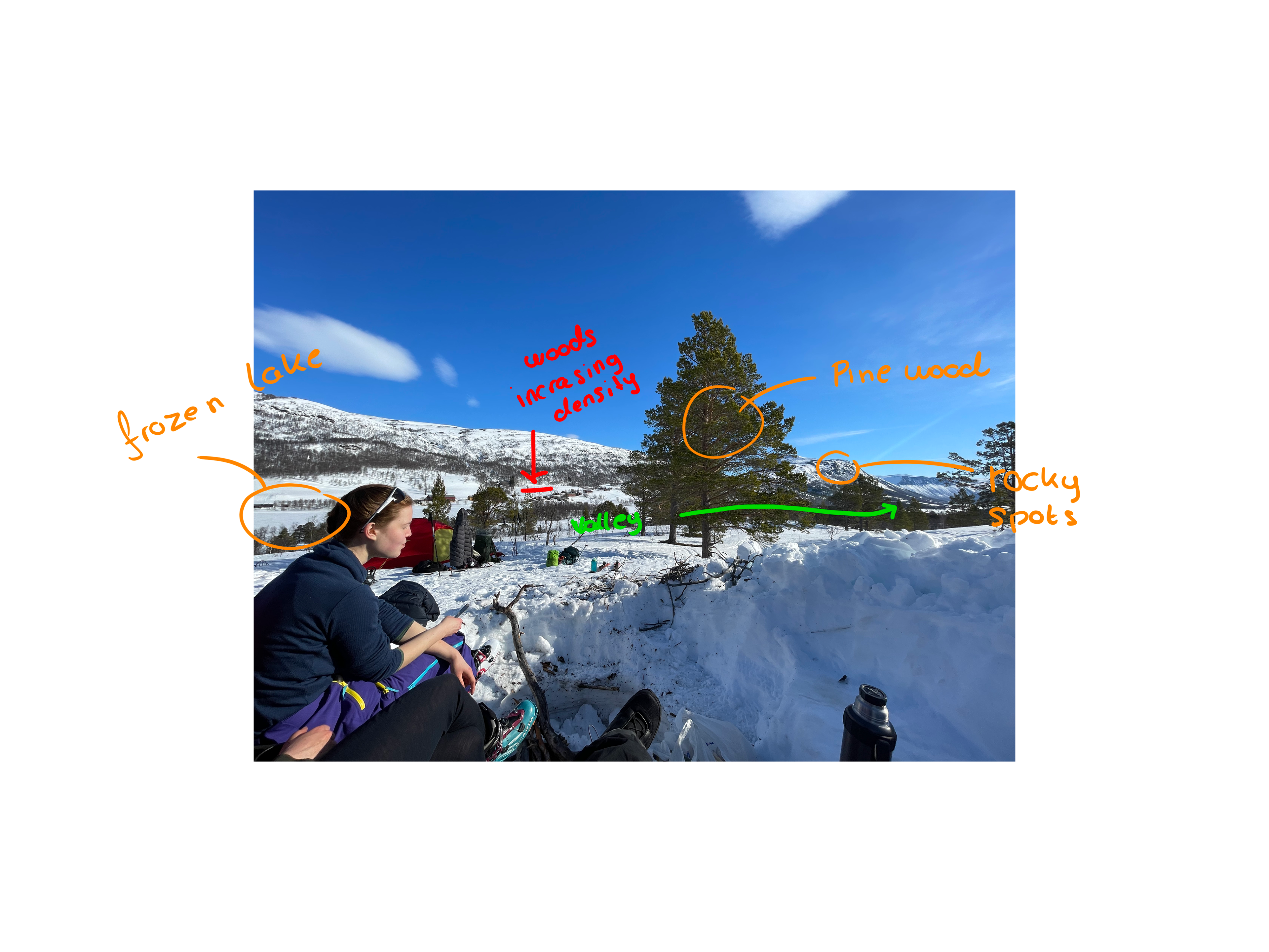
I decided to recreate a landscape I visited in my home country, Norway. I used images I had taken there as reference photos.
I did several observations during analysis of these.
- there were no trees in the bottom of the valley due to lakes, rivers and logging
- the density of the forest decreased towards higher altitude
- the shapes of the trees (triangular or round)
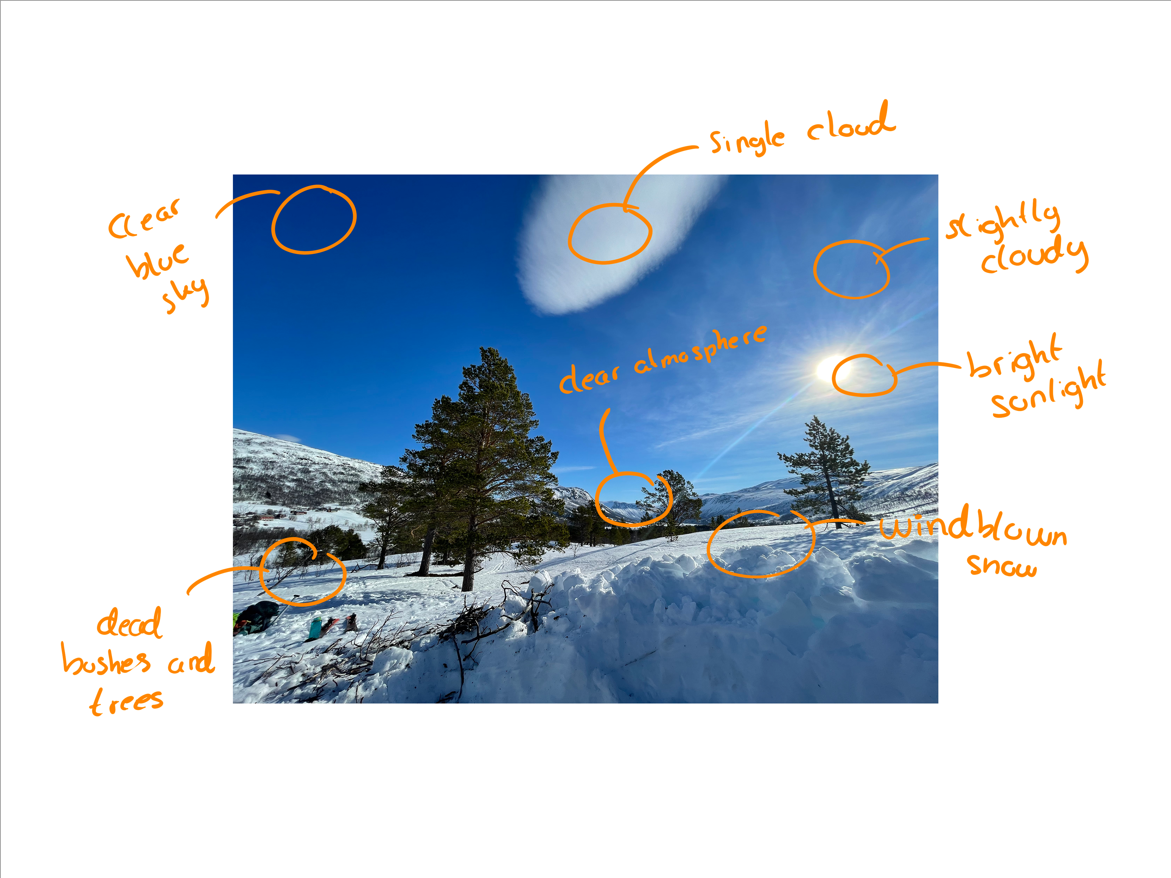
- some dead bushes, trees and branches
- The atmosphere was clear and provided good visibility of the landscape
- it is bright and early in the afternoon
- some translucent clouds and some dense clouds
- the hills and the mountains revealed their icy/rocky surface in steep areas
- the valley curves slightly
- The overall landscape exhibits a more gradual change in elevation compared to the abrupt and rugged features of steeper mountains
- snow-covered terrain with a wind-sculpted surface
- The forest's densest areas are not very dense
I divided the foliage spawner into two segments, one atop the other, in order to create the illusion of increasing density within the forest.
I struggled to create a heightmap using heightmapper without getting steps in the terrain, and I could not find any software available for MacOS that could generate terrain. I had to look for heightmaps elsewhere in order finish the project in time. I found an alpine landscape, and started adjusting the scaling until the slopes looked smoother and more gradual.
I estimated from the images that the dead trees was a rare occurrence compared to the others. In retrospect I would have increased the occurrence of the dead bushes, after having a closer look at the reference images.
I did not manage to find tree-assets for pine-trees, but found some that resembled its looks. I looked at the shape and the way they branched out (referring to the gaps between the branches).
While rendering the project I noticed a line in the sky in a couple of the shots taken from higher altitudes, and I decided to remove the shots.